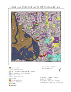
Module 4 - Ground Truthing and Accuracy Assessment
This week, we checked the accuracy of our land cover classifications from last week by conducting an accuracy assessment using the street view on google maps. I used a random sampling method so that I could choose as many unique locations as possible. Because so much of the map falls under the residential and Streams and Canal categories, I felt it was important to verify the smaller areas like Bays and Estuaries, Lakes, etc. were correct. First, I zoomed into the map to select smaller locations (around 20). Then I zoomed out and filled in the gaps with more random points for verification.


Comments
Post a Comment