Posts

Showing posts from November, 2017

Georeferencing - Week 12 Lab

Image
This week, we used georeferencing to assign location information to data and create a new polygon and polyline. Then, we created a buffer to show the protection area for a bald eagle’s nest. The only issue I ran into during this part of the lab was hyperlinking the eagle’s nest image. It was difficult to locate the I drive.  Next, we created a 3D version of the map in ArcSpace, saved it in a 2D format, and opened it in ArcMap to create a different aesthetic. ArcSpace was a very interesting tool and reminded me of Google Maps. I liked that the elevation model behaved like a “sheet” and I feel this program opens up many new possibilities for displaying data.  Section 3:   Buffer Analysis – Hyperlinking Data and Adding Multiple Ring Buffer to a Toolbar 1. First, I located the image EaglesNest.jpg, but I could not find the I:/ drive to paste it to. I looked up information on this drive on the UWF page, but the link provided to paste it to was broken. I dec...
Geocoding - Week 11 Lab

Image
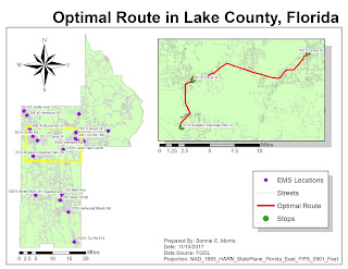
This week geocoded emergency management service sites in Lake County, Florida. By importing data from the US Census Bureau, I was able to network EMS sites with address information. The only problems I encountered during parts 1 and 2 of this weeks lab were with locating addresses that had candidates that didn't match. It was still necessary to use the manual select from the map tool. The third section of the map required me to use a model builder to set certain parameters that locate areas around schools where gas companies regularly check for gas leaks.  I liked this method because it made the steps for creating a map visual. Section 1: Geocoding – Step 4: Research Locations and Match Addresses 1.      I right clicked EMS in the TOC and selected “Geocode Addresses” 2.      I added the MyAddressLocator layer and changed the Minimum match and candidate score 3.      The first method I used t...

Vector 2 - Week 10 Lab

Image
This week we used buffers and overlays to highlight areas on the map within specific parameters. The purpose of my map was to specify ideal campsites. Using the afformentioned tools I was able to narrow down areas within 300 meters of a road, within 150 meters of a lake, within 500 meters of a river, and outside of conservation areas.  While the appropriate overlay methods were pretty obvious for this lab, I feel comfortable with the others as well. The only problems I ran into were with ArcPy. I created the first layer with no problems, but using Shift+Enter and copy/paste did not work for me. Pressing enter after I had my information input correct would only make another line with "..." as the indention. It was necessary to clear the field contents and create each layer individually.  My process summary for future reference:  Step 5: The Union 1.      First, I separated the features that were inside or outside the water buffer by a...